
search
Rome districts map
Rome neighbourhood map. Rome districts map (Lazio - Italy) to print. Rome districts map (Lazio - Italy) to download. Rome is the largest of Italy 8101 comuni, and is governed by a mayor, and a city council. The seat of the comune is in on the Capitoline Hill the historic seat of government in Rome. Rome is divided into 19 administrative districts as its shown in Rome districts map, called municipi, each of which districts is governed by a president and a council of four members who are elected every five years.
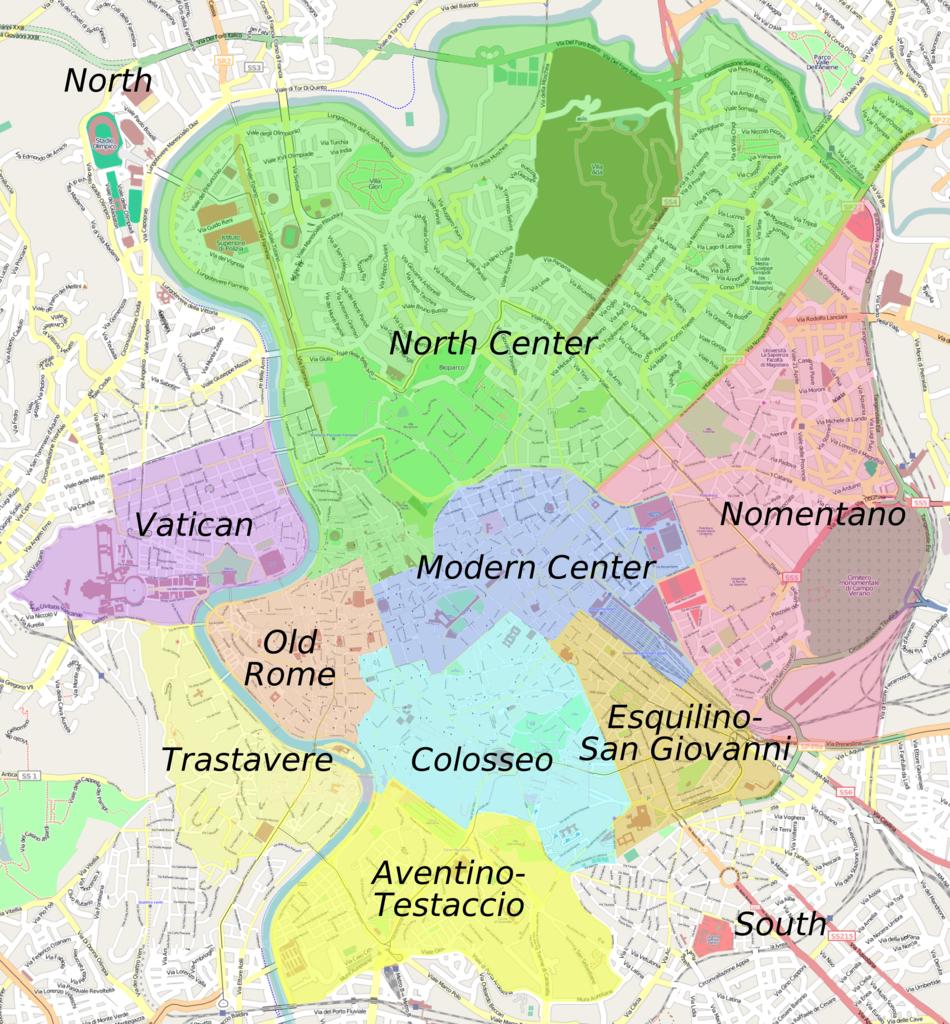
Since 1972 the city has been divided into 19 (originally 20 as its mentioned in Rome districts map) administrative districts, called municipi (sing. municipio) (until 2001 named circoscrizioni). They were created for administrative reasons to increase decentralisation in Rome. Each district is governed by a president and a council of four members who are elected by its residents every five years. The district frequently cross the boundaries of the traditional, non-administrative divisions of Rome.
A new subdivision of Rome under Napoleon was ephemeral, and there were no sensible changes in the organisation of the city until 1870, when Rome became the third capital of Italy. The needs of the new capital led to an explosion both in the urbanisation and in the population within and outside the Aurelian walls (see Rome districts map). In 1874 a fifteenth rione, Esquilino, was created on the newly urbanised zone of Monti. At the beginning of the 20th century other rioni where created (the last one was Prati – the only one outside the Walls of Pope Urban VIII – in 1921). Afterward, for the new administrative subdivisions of Rome the name "quartiere" was used as districts. Today all the rioni, except Borgo and Prati, are part of the first Municipio, which therefore coincides almost completely with the historical city (Centro Storico).