
search
Rome region map
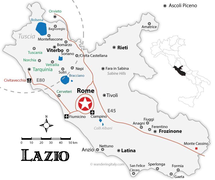
Rome regions map. Rome region map (Lazio - Italy) to print. Rome region map (Lazio - Italy) to download. In the region of Rome, the closest to the Eternal City, beautiful discoveries can be made in regions like Tivoli, Ostia, and in the hills of the Castelli Romani as its shown in Rome region map. A little further away, the first Etruscan remains can be discovered, and not the least, such as the immense necropolis of Cerveteri, one of the most fascinating sites in the area.
Rome regions (Latin proviniciae, singular provincia) were administrative and territorial units of the Roman Empire, established by various emperors as revenue-generating territories throughout Italy and then the rest of Europe as the empire expanded (see Rome region map). The governors of the Rome regions were often selected from men who had been consuls (Roman magistrates), or former praetors (the chief justice of magistrates) could also serve as governor.