search
Rome metro station map
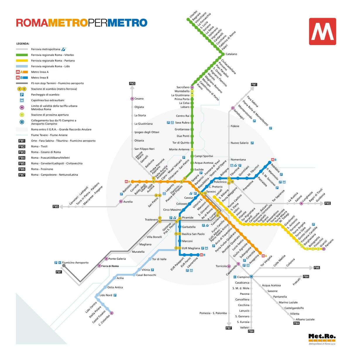
Map of Rome metro station. Rome metro station map (Lazio - Italy) to print. Rome metro station map (Lazio - Italy) to download. To reach the Vatican Museums, Cipro metro station of Rome is the closest but not necessarily the most convenient if you arrive when a long line to the entrance has already formed as its mentioned in Rome metro station map. To avoid having to walk to the end of the line and extended waiting, try visiting in the afternoon or midday. From Piazza di Spagna metro station line A many major attractions are within walking distance: Pantheon, Piazza Navona, Trevi Fountain. Use metro line B for Ancient Roman sites: it will carry you directly to the Colosseum with nearby Roman Forum and to Circo Massimo which is close to the Caracalla Baths.
Most Metro stations in Rome may be accessed from multiple street corners as its shown in Rome metro station map. Look for the big M. The most common use of the Rome Metro is to get from Termini station (the main train station in Rome), to the Colosseum (blue line B, 2 stops) or the Vatican (red line A to Ottaviano, 6 stops.). You may also purchase metro tickets inside any Rome metro station.
Although Rome airports are not directly serviced by the metro system, all trains and buses departing from Fiumicino Airport to the city centre will stop at either Termini Central Train Station, where you will find the major metro station from which to catch all metro lines in all directions as you can see in Rome metro station map, or at Tiburtina, Ostiense, or Trastevere train stations which will also connect you with the metro lines.


