
search
Appian way map
Appian way Italy map. Appian way map (Lazio - Italy) to print. Appian way map (Lazio - Italy) to download. The Via Appia Antica is the old Roman Appian Way, one of the oldest and most important roads from Rome. During ancient Roman times, the appian way was essential in transporting troops down to the port of Brindisi in southeast Italy. Tourist attractions along the Appian Way include the Catacombs of San Callisto and Catacombs of San Sebastiano as well as various basilicas and tombs as its shown in appian way map.
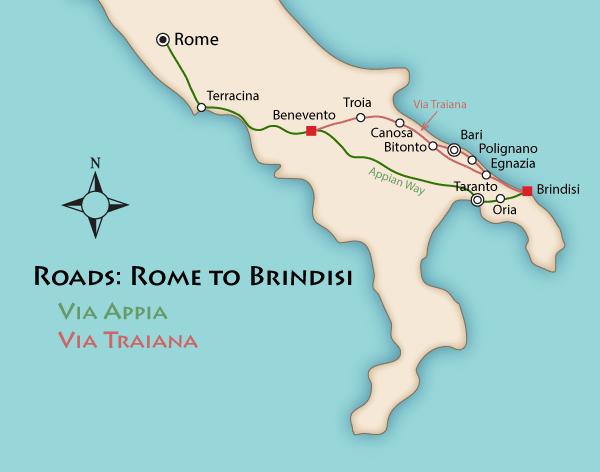
The Appian Way is Rome gateway to the East, it was Europe first super highway and the wonder of its day. Built in 312 BC, the appian way connected Rome with Capua (near Naples), running in a straight line for much of the way. Eventually it stretched 400 miles to Brindisi as its mentioned in appian way map, from where Roman ships sailed to Greece and Egypt.
Walking along the Via Appia Antica or the appian way is a refreshing change from the city, you can also hire bikes from the visitor centre. The appian way is attractive and atmospheric, with plenty of grassy spots where you can picnic. You could easily spend a whole day in the appian way, but with so much else to see in Rome most visitors spend two hours or less. The Parco Regionale dell'Appia Antica is a big place (see appian way map), you can even go on long bike rides of over 30km within the park.