
search
Rome bus 40 route map
Map of Rome bus 40 route. Rome bus 40 route map (Lazio - Italy) to print. Rome bus 40 route map (Lazio - Italy) to download. Rome 40 bus has a shelter outside Termini station with all the other buses as its shown in Rome bus 40 route map. As this is an express bus or Rome bus 40 it does not stop at all the stops along the route. But it is very easy to get from Stazione Termini to see things such as the Pantheon, Campo di Fiori, Piazza Navonna, the Vatican and the Trevi Fountain.
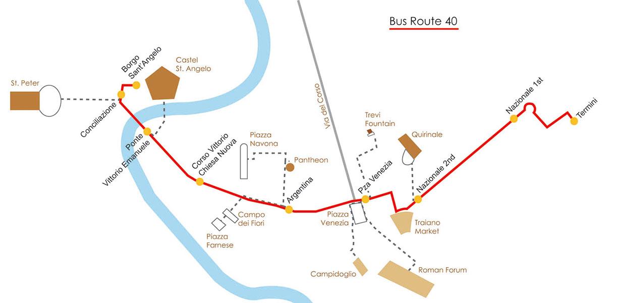
Use the 40 'express' bus to get between Termini and the Vatican area. The Rome bus 40 and Rome bus 40 express are the same thing. There were buses about every 10 minutes. In rush hour, 08:30 weekday morning, it took about 25 minutes to get from the start to Termini. It needs about 10 to 15 minutes to get to Piazza Venezia. The buses go from Termini to Borgo St. Angleo (Point A on the Rome bus 40 route map). Buses wait there until they are scheduled to start from the 1st stop which is around the corner in Piazza Pia (Point B on the Rome bus 40 route map) for the return to Termini.