
search
Rome bus map
Roma bus map. Rome bus map (Lazio - Italy) to print. Rome bus map (Lazio - Italy) to download. Rome has an extensive bus system, allowing you to get almost anywhere in Rome as its shown in Rome bus map, even to many parts outside Rome. Rome bus is the slowest way to go, but it can be an adventure and/or scenic if the bus is not too crowded. Rome has currently 338 bus lines that run throughout the day, 22 night buses and 8,260 stops, and it can sometimes be a bit confusing to find the right bus.
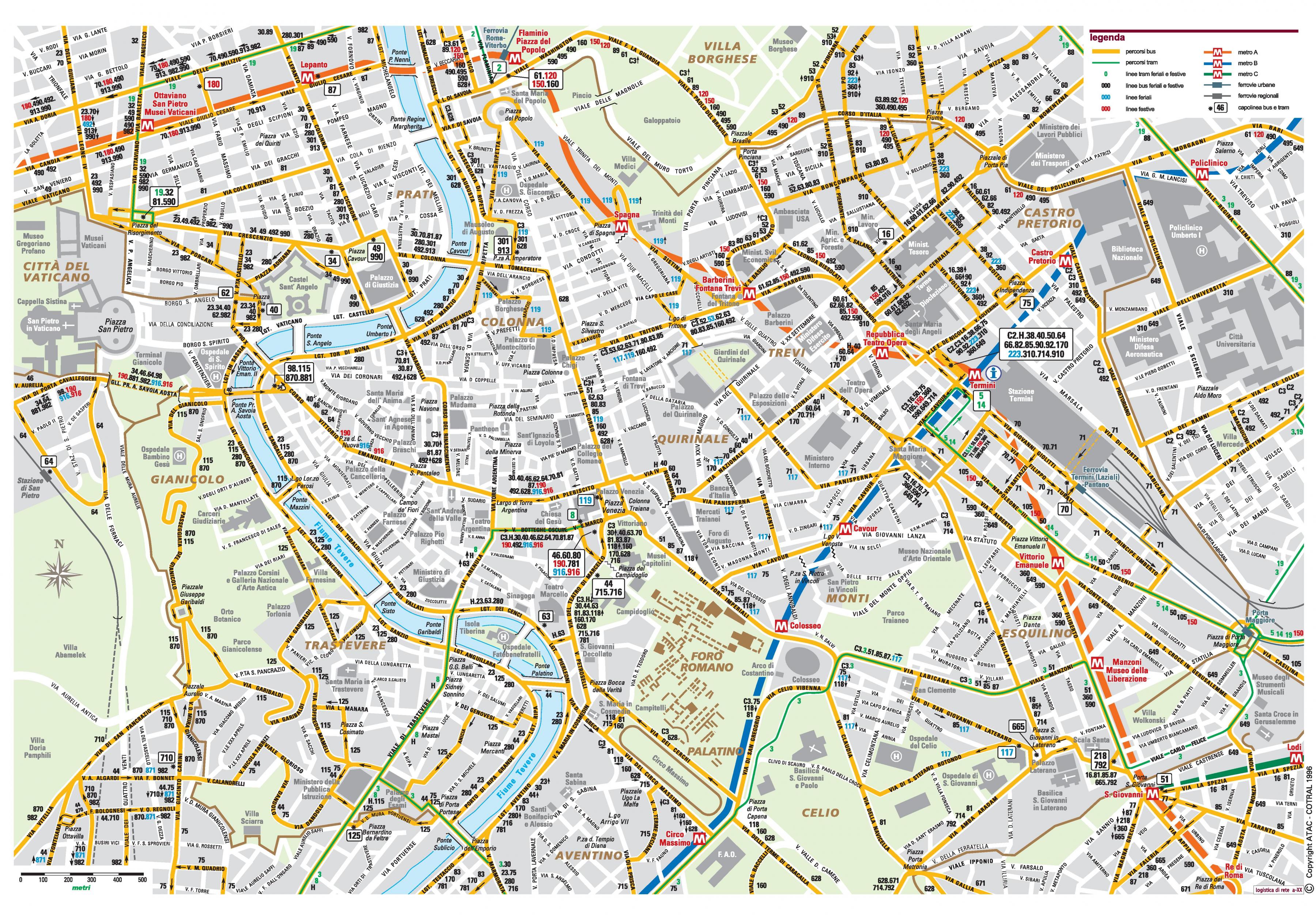
The classic bus lines of Rome operate from about 5:30 a.m. to midnight; then about twenty special night lines (linee notturne), indicated in black on the ATAC panels and distinguished by the letter "N" as its mentioned in Rome bus map. Increasingly, a device announces the next stop, which is called "Fermata" and can be identified by a yellow sign. Rome bus routes are possibly the most complex of Europe. The most important information is found on each bus stop. This includes Rome bus route, the first and last bus and its timetable.
Since the metro lines of Rome are rather limited, visitors will most likely need the bus public transport system to get to certain parts of the city. Rome bus may not be the most comfortable or punctual form of transportation. Nevertheless, to get to certain monuments and museums it is essential to use the bus as its shown in Rome bus map. Bus tickets can be bought in any metro station, news-stand or convenience stores.
In Rome there are various types of lines, these are the most popular: Urban bus lines (U): The large majority. They start between 5 am and 6:30 am and finish at midnight. Night buses (N): These lines operate while the urban lines "rest", that is to say, between midnight and 5:00-6:00 am. Express bus (X): These lines are for the outskirts of Rome, for longer journeys. Exact bus (E): These lines link the centre with the surrounding neighbourhoods as you can see in Rome bus map. They run on fixed timetables.