
search
Rome train map
Rome Italy train map. Rome train map (Lazio - Italy) to print. Rome train map (Lazio - Italy) to download. The urban trains in Rome, called Ferrovie Urbane, complement the three metro lines and are run by the same company. The tickets are the same and the prices too. The Ferrovie Urbane or Rome train is made up of following three lines: Rome – Lido, Rome – Viterbo, Rome – Giardinetti as its shown in Rome train map. Of these train lines the most important from a tourist point of view is the Rome-Lido, since it stops at Ostia Antica.
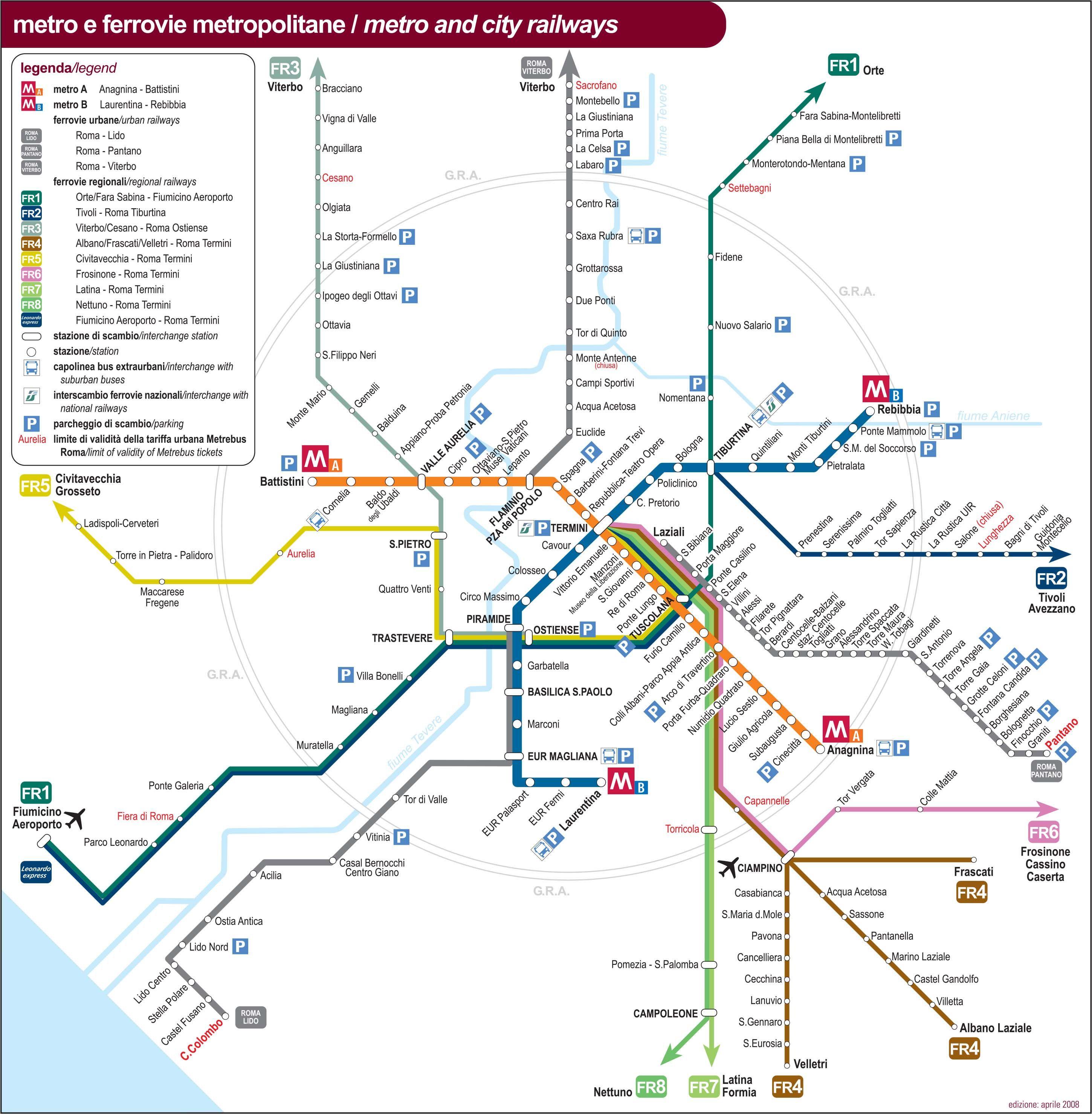
The Rome train is a great way of seeing Italy with a good network of inter-city and regional, plus urban services. For the most part train is a much stronger proposition than any bus services between major towns and cities, buses largely only compete on urban and some regional services. Trains serving Rome are no exception. The main central station in Rome is Termini Station as its mentioned in Rome train map.
The FL lines are the Rome commuter trains, consisting of eight lines, operated by Trenitalia, with Rome as its hub as its shown in Rome train map. Rome trains are at good frequencies and are essentially commuter trains, some of which have double deck carriages. As the parts of Rome that are of interest to the visitor is a rleatively compact area in the centre of Rome, this network is of limited use to the average visitor.
Since the tickets are the same as other forms of public transportation in Rome, these can be bought in urban train stations, metro stations, news agents and convenience stores. Urban trains run approximately from 5:30 am to 10:30 pm. The Rome-Lido line train runs until later, till 11:30 pm. Rome trains leave every 10 to 20 minutes, depending on the time of day.