
search
Rome tram map
Tram map Rome Italy. Rome tram map (Lazio - Italy) to print. Rome tram map (Lazio - Italy) to download. There are a limited number of trams in Rome, all part of the ATAC Rome public transportation system. The trams are all in strategic spots, connecting to either a metro or bus stop, making it very easy to get quickly to locations the metro cannot always go, such as the auditorium or MAXXI museum as its shown in Rome tram map. However, a short route on tram line 3 is recommended if you want to do some sightseeing. The tram line connects the pretty district of Trastevere to the northern districts of the city, passing by the Colosseum and the Circus Maximus.
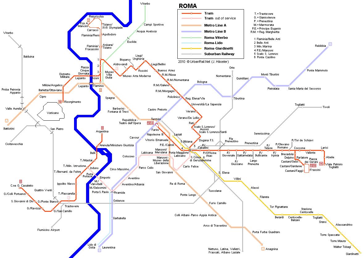
The tram network in Rome has six lines as its shown in Rome tram map: Tram line 2: Piazza Mancini – Piazzale Flaminio. Tram line 3: Piazza Thorwaldsen – Trastevere. Tram line 5: Giovanni Amendola – Piazza dei Gerani. Tram line 8: Torre Argentina – Trastevere. Tram line 14: Giovanni Amendola – Palmiro Togliatti. Rome tram line 19: Piazza Risorgimento – Piazza dei Gerani.
Rome trams are usually cleaner than the buses and are also considered by many more romantic. Nonetheless, the tram lines are small and the fact that the network does not get to the city centre makes it less appealing for visitors. It is important to point out that none of Rome tram lines, unless if one of them stops at the door of your hotel, has any special attraction for tourists. The best tram line for travellers is perhaps number 8, which links Trastevere with Largo di Torre Argentina as you can see in Rome tram map.
Above-ground public transport in Rome is made up of a bus, tram and urban train network (FR lines). The Rome bus and tram network is run by Trambus S.p.A. under the auspices of Atac S.p.A. (which originally stood for the Municipal Bus and Tramways Company, Azienda Tramvie e Autobus del Comune in Italian). The more-limited tram system has 39 km of track and 192 stops as its shown in Rome tram map.